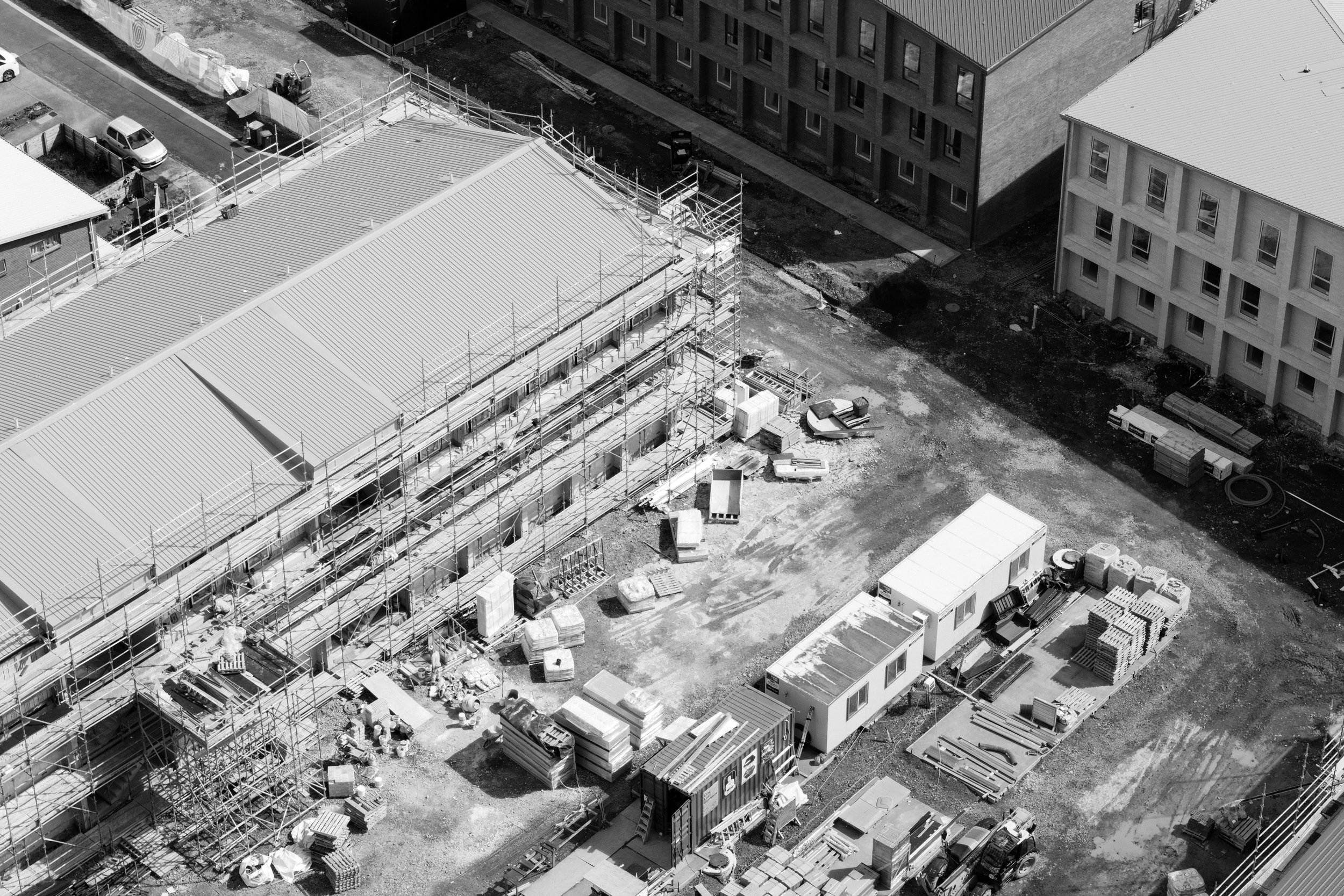
About Clarkland.Clarkland is a drone mapping and site intelligence business based in Auckland, New Zealand. We work with construction companies, project managers, and developers who want better visibility of their sites — and an accurate, timestamped record of how their projects progressed.
We're built around one belief: that the data a drone can collect in a single flight is more useful, more accurate, and more actionable than most construction teams realise. And that it should be delivered in a way people can actually see and act on — not buried in a PDF of numbers.
The operator
Clarkland is operated by Glenn Manchester — a CAA Part 102 licensed drone operator, professional camera operator, and photographer with 18 years of commercial experience.
Glenn's visual work spans some of the world's most demanding production environments — campaigns for Ferrari, Harley-Davidson, Red Bull, Adidas, Steinlager and Westpac, documentary and commercial projects across New Zealand and internationally, and winery work from Napa Valley and the Adelaide Hills to Marlborough, Hawke's Bay and Central Otago. For 12 of those years, drones have been a core part of that toolkit.
Construction sites have been part of the picture throughout — site documentation, progress updates, aerial content for project teams. But it was a chance encounter with photogrammetry while completing a commercial drone licence in the USA that changed the direction entirely.
The technology was transformative. The opportunity in New Zealand's construction sector was obvious. And the combination of drone operations, visual communication, and an instinct for making complex information legible was exactly the foundation it needed.
Clarkland is the result.
The platform
We use DroneDeploy as our primary mapping and data platform — a leading cloud-based construction mapping tool used by over 10,000 companies globally. It allows us to deliver outputs that integrate directly with the tools your team already uses, including Autodesk Construction Cloud, BIM360, Procore, and standard CAD environments.
Everything we capture is stored securely in the cloud and shareable with whoever needs it, for the duration of your access period.
The operations
All flights are conducted under a CAA Part 102 operator certificate — the advanced certification issued by the Civil Aviation Authority of New Zealand. It allows us to operate beyond the limitations of standard drone operators, including on and around active construction sites, in controlled conditions, and in situations that require a formal safety case.
All flights carry full commercial public liability insurance. We manage all NOTAM filings and airspace authority communications on your behalf.
Based in Auckland. Operating across Auckland & Waikato.
We're currently taking project inquiries for sites across greater Auckland and Waikato. If your site is further afield, get in touch — we're happy to discuss options.
CAA Part 102 Licensed Operator
Commercial Public Liability Insurance
DroneDeploy Certified Platform
NZCAA Compliant Operations
Serving Auckland & Waikato